Accuracy and precision are paramount in the current fast-paced world, especially in the construction, agricultural, mining, and urban planning industries. Aerial mapping has been a tool of utmost importance in such spheres, but has undergone a colossal revolution with the advent of drone technology. Drones have changed the way we take, analyze, and perceive the world from an elevated perspective. What might have cost a lot of money and time and required manual surveying can now be performed within a few hours, more accurately and efficiently. A leading drone-mapping provider is at the forefront of this technological change, offering state-of-the-art services that have transformed the accuracy of aerial data delivery.
The Change of Classical Mapping to Drone-Based Mapping
Old forms of aerial mapping relied on human-piloted aircraft and satellite imagery. Although effective for large-scale surveys, these methods had several disadvantages. Aircraft rental costs, complex flight planning, and limited availability of satellite imagery often restricted the frequency and precision of mapping. Terrain and weather conditions added further challenges.
Drone technology changed all of that. UAVs equipped with powerful cameras, advanced GPS, and modern sensors can fly at low altitudes, capturing images from multiple angles to create detailed, highly accurate 3D models of any landscape. This allows surveyors and engineers to gather real-time data with far greater precision. Modern drone service teams now achieve centimeter-level accuracy, something standard aerial methods struggled to deliver even a decade ago.
The Role of Drones in Improving Mapping Accuracy
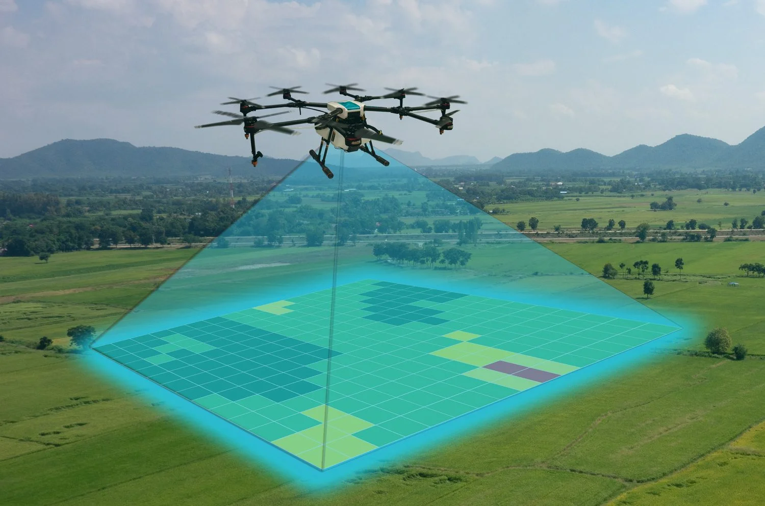
Aerial mapping accuracy depends on image resolution, positional precision, and data processing. Drones excel in all three areas. Today’s UAVs can capture images with extremely low ground sampling distances, ensuring that even small features are recorded clearly. With RTK and PPK positioning systems, positional errors are minimized significantly.
Using a combination of photogrammetry and LiDAR, advanced mapping companies produce incredibly detailed 3D terrain models. Photogrammetry converts aerial images into accurate surface models, while LiDAR penetrates vegetation to retrieve true ground elevations. Thanks to these dual technologies, even complex or obstructed environments can be mapped with exceptional reliability.
Cost Savings and Time Efficiency
One of the greatest advantages of drone-based mapping is efficiency. Tasks that formerly required days or weeks can now be completed in hours. UAVs swiftly cover large areas, capturing hundreds of high-quality images in a single flight. Mapping software then processes this data into contour lines, volumetric measurements, and detailed site maps.
Clients of professional drone-mapping providers benefit from fast turnaround times, allowing them to track construction progress, plan agricultural layouts, or assess mining sites more effectively. Compared to traditional aerial surveys which require pilots, aircraft, fuel, and extensive manual processing drone mapping delivers equal or superior accuracy at a fraction of the cost.
Greater Safety and Reduced Risk
Safety is another major advantage of drone technology. Many mapping environments pose risks to human surveyors such as cliffs, unstable ground, or high structures. UAVs eliminate the need for physical presence in dangerous locations. They can fly over hazardous or inaccessible areas while keeping personnel completely safe.
Experienced drone crews follow strict airspace and safety regulations with every mission. This commitment to compliance ensures secure operations and dependable data collection, even in the most challenging settings.
Real-World Applications of Drone Mapping
Drone-based mapping has numerous applications:
- Construction: track progress, measure volumes, detect structural issues
- Agriculture: generate precise topographic maps for irrigation and crop planning
- Mining: calculate excavation volumes, monitor site changes, assess environmental impact
- Urban planning: support zoning, infrastructure design, and land-use analysis
- Environmental management: track erosion, forest conditions, and watershed changes
These diverse applications highlight how essential high-resolution aerial data has become across industries.
The Future of Aerial Mapping
As drone technology continues to advance, mapping accuracy and capabilities will expand even further. Next-generation UAVs will include improved AI-powered flight systems, enhanced sensors, and real-time cloud-based data processing. Such developments will support instant analysis and faster decision-making.
Forward-thinking mapping providers are consistently adopting these innovations, upgrading fleets, refining software, and improving workflows to ensure clients receive the highest-quality geospatial data possible.
Conclusion
Drone technology has not only enhanced aerial mapping but completely reinvented it. By making data collection more precise, cost-effective, and safe, UAVs have become indispensable tools for modern industries. Leading mapping companies continue driving this transformation, giving businesses the ability to view, understand, and manage their environments with unprecedented clarity.